Sea Level Monitoring
TSU/MAB Coastal Hazards Project
The second edition of the Post-Tsunami Survey Field Guide has been realeased
The second edition of the Post Tsunami Survey Manual has been released by UNESCO’s Intergovernmental Oceanographic Commission (IOC).
This new Field Guide addresses developments in the tsunami field since 1998, and the expansion of International Tsunami Survey Team (ITST) efforts into disciplines and technologies not covered in the first Guide. The Guide provides a flexible framework for undertaking post-tsunami surveys, their guiding principles, and protocols and a set of best practices and templates for individuals and groups considering forming, or participating, in post-tsunami surveys.
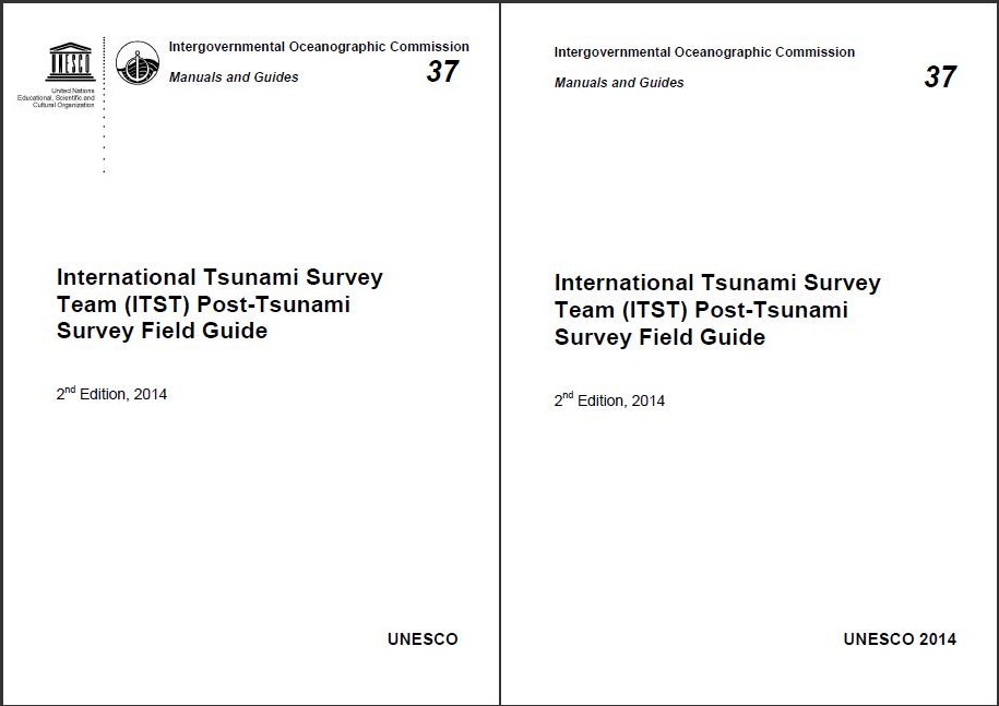
It can be downloaded at http://unesdoc.unesco.org/images/0022/002294/229456E.pdf
Print copies are available from Patrice Boned (This email address is being protected from spambots. You need JavaScript enabled to view it.) or Thorkild Aarup (This email address is being protected from spambots. You need JavaScript enabled to view it.)
Community drill exercise for tsunami in the district of Petit Anse-Cap Haitian, Haiti
The first community drill exercise in case of tsunami in Haiti was conducted in the district of Petite Anse in Cap Haitian on July 17, 2014. At 9: 00 AM the members of the "Community Response Teams - EICs" in Petite Anse, started mobilizing the population to the assembly point where about 600 people were educated on tsunami risk.
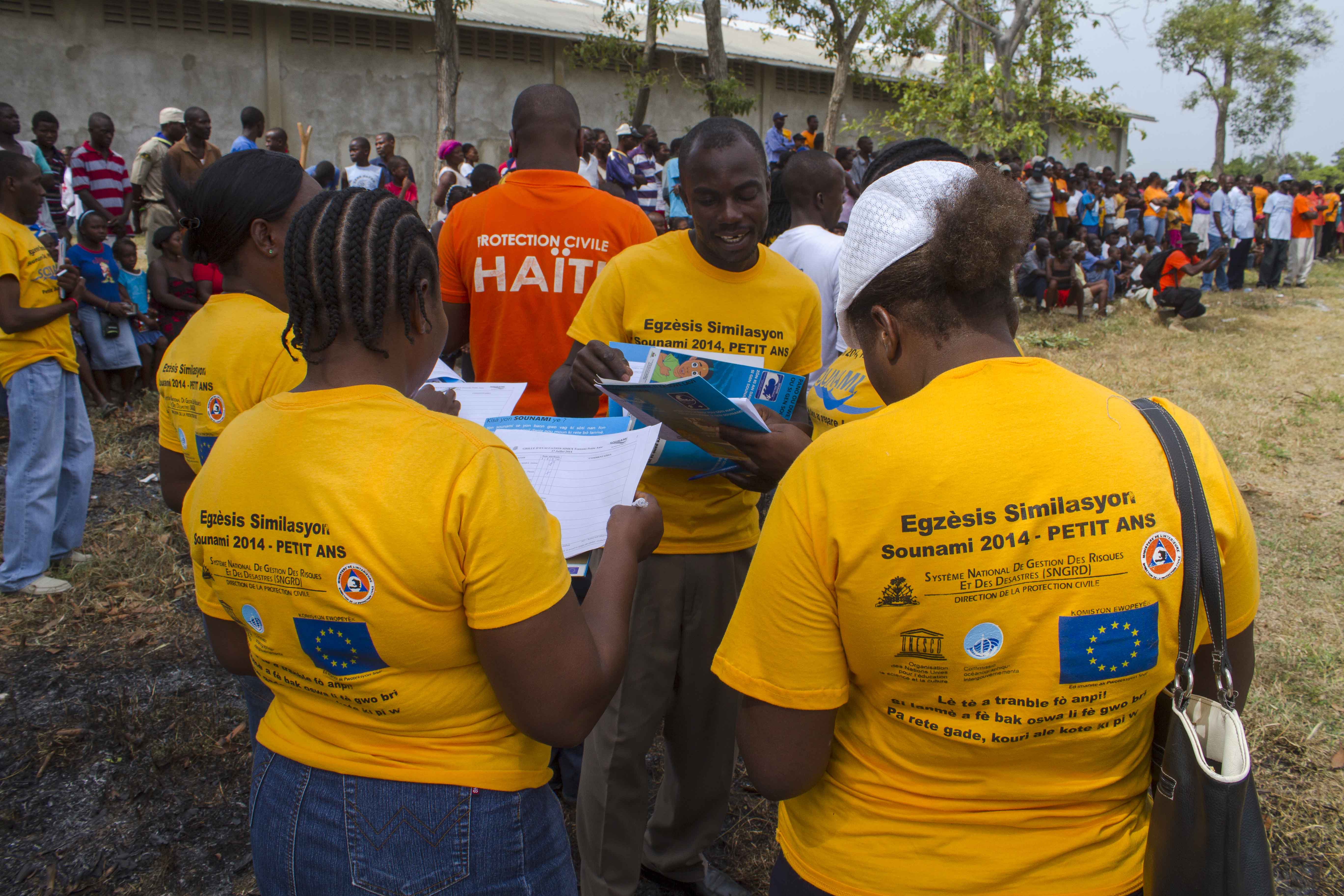
218 volunteers (Scouts, Rangers, Red Cross) were involved in securing the evacuation axes and 55 staff on medical safety. Public safety (crowd movement and traffic) was taken by the police (National Haiti, UNPOL and MINUSTAH Police) who deployed 142 staff.
The Director of Civil Protection, Mrs. Marie Alta Jean Baptiste, congratulated the institutions involved in the organization, for the excellent safety tools deployed and for mobilizing key actors working in the management of risks and disasters at Community level in the area of Petite Anse. This area is highly vulnerable to tsunami threat because it was urbanized by infilling of mangroves and building homes that do not meet basic standards of construction. The vulnerability of the population is exacerbated by the lack of knowledge of tsunami risk.
As part of the preparation of this simulation exercise, members of the local committee for risk and disaster management (CLGRD) in Petite Anse were trained on the tsunami threat and outreach door to door was conducted. This simulation is a significant public awareness exercise and provides a training opportunity for community actors to strengthen their organizational capacity and response in case of tsunami.
This activity was organized in the framework of the project "Consolidating Haitian capacities for tsunami early warning and preparedness" coordinated by the National System for Disaster Risk Management and UNESCO and funded by the Directorate General of Humanitarian Aid and Civil Protection of the European Commission (ECHO).
Third Session of Community Workshops on Tsunami Preparedness and Response for Dominican Republic
Two training workshops on tsunami preparedness and response for Dominican Republic were held in Santo Domingo and Las Terrenas on July 14-15 and July 17-18, 2014, respectively. The events were hosted by the Global Foundation for Defense (FUNGLODE), thru its Center for Security and Defense, and the National District and Las Terrenas municipalities. Over 250 participants from namely Neighborhood Associations, Firefighters, Civil Defense, Police, Red Cross, Schools, Local Governments, Faith Based Organizations, Hotel Associations and Private Sector benefited from the lectures and exercises. The objective was to encourage the establishment of preventive measures through education, to outline procedures and foster a culture of disaster prevention by empowering local institutions and neighborhoods resulting in the protection of life, property and livelihoods for tsunami events.
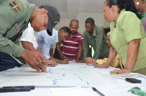 The training included presentations and three hands on exercises on tsunami evacuation mapping, community and organizational standard operational procedures and a table top exercise with southern and northern Dominican Republic earthquake/tsunami scenarios. The workshop was conducted by a team of 8 trainers from Puerto Rico and Dominican Republic, the National Meteorological Organization, the Center for Emergency Operations, Civil Defense, National Emergency Commission, Global Matrix Engineering, Puerto Rico Seismic Network and the Caribbean Tsunami Warning Program (NWS/NOAA) with support from the Dominican Media Association and IOC/UNESCO. This was the third time that FUNGLODE has hosted this training in the Dominican Republic since 2012.
Workshop on Standard Operating Procedures for Tsunami Warning and Emergency Response for Northern and Western Indian Ocean Countries
A regional training workshop on tsunami warning and emergency response Standard Operating Procedures for Northern and Western Indian Ocean countries was held in Hyderabad, India, 23-26 June 2014, hosted by the Government of India through the Indian Centre for Ocean Information Services (INCOIS). The workshop was attended by 30 participants from 11 countries, namely: Comoros, India, Islamic Republic of Iran, Kenya, Madagascar, Maldives, Mauritius, Mozambique, Seychelles, Tanzania and Yemen. The workshop was conducted by a team of 10 trainers from Australia, India, Indonesia, United States, the Asia-Pacific Broadcasting Union, UNESCO Disaster Risk Reduction and Tsunami Information Unit, Jakarta and IOC UNESCO.

The participants represented National Tsunami Warning Centres (NTWCs), Disaster Management Organisations (DMOs) and national media organisations. The workshop programme included lecture sessions, breakout group work, and a site visit to the Indian National Tsunami Warning Centre and IOTWS Regional Tsunami Service Provider at INCOIS. The lectures and training material were based on manuals and templates developed by IOC UNESCO in collaboration with the NOAA International Tsunami Information Centre (ITIC) since 2008.
The primary objectives of the workshop were: to understand RTSP services and products; to understand the impact of the RTSP products on NTWC SOPs; to identify potential gaps and possible challenges for warning chain SOPs at the national level; to familiarise the electronic media with the RTSP service and develop/adapt SOPs for interfacing with the media; and to prepare for the IOWave14 Exercise, scheduled to take place on 9 and 10 September 2014.
The tabletop exercise on the last day of the workshop provided the participants with an opportunity to put into practice what they had learned. The exercise evaluation took the form of a simulated press conference, with NTWC and DMO representatives facing questions from the media and exercise observers.
The workshop was followed on 27th June by intersessional meetings of the IOTWS Working Group 2 on Tsunami Detection, Warning and Dissemination, Working Group 3 on Tsunami Awareness and Response and the Task Team for the IOWave14 Exercise.
Funding to support the participants' travel and subsistence was provided from IOC Special Account funds contributed by the Government of Australia, with funding for local hosting support provided by the Government of India.
ASSESSMENT OF COASTAL HAZARDS, VULNERABILITY AND RISK FOR THE COAST OF OMAN
The Assessment of Coastal Hazards, Vulnerability and Risk for the coast of Oman, undertaken by the Environmental Hidraulic Institute of the University of Cantabria (IHC) covers two different resolutions: 1) Overall risk assessment along all the coast of Oman. 2) Detailed risk assessment for 9 selected cities (Sohar, Wudam, Sawadi, Muscat, Quriyat, Sur, Masirah, Al Duqm, and Salalah).
The main goal is the development of the Multi Hazard Risk Assessment System (MHRAS) addressing TWO specific hazards: Tsunamis and Storm Surge. The MHRAS will provide:
1. The scenario database to feed the Multi Hazard Early Warning System that the Government of Oman is currently implementing supported by IOC-UNESCO for the protection of population and goods during an event.
2. Hazard, vulnerability and risk maps for tsunami and storm surge, as basic tools to develop a safe planning for land and coastal management; including an atlas of possible risk mitigation measures.
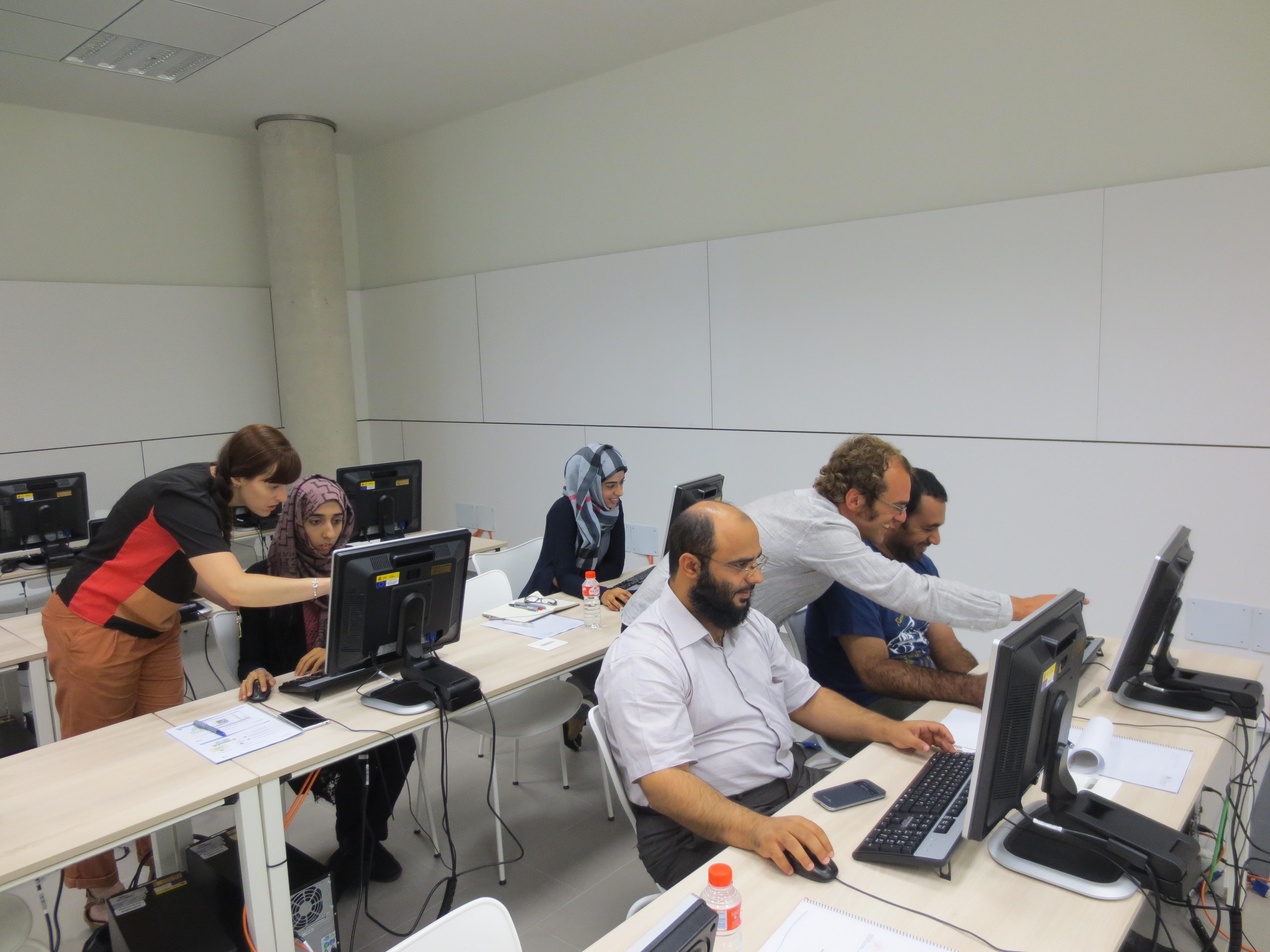
Apart of the MHRAS platform, the work done by IHC includes two more components, being the first of them the development of a set of seasonal and short term forecasting tools for the regular marine climate and the tropical cyclones. Technology transfer is another important component of the project. In order to train several members of the meteorological service of Oman in the numerical models and working methodologies developed by IHC the hazard, vulnerability and risk assessment, a set of workshop have been included as part of the project.
More Articles...
- US Virgin Islands hosted the Ninth session of the Caribbean tsunami Warning System
- The Oman National Multi Hazard Early Warning System 2nd Workshop on Standard Operating Procedures for Tsunami Early Warning Systems
- Preparing for NEAMWave14 tsunami exercise
- Development and Strengthening of Tsunami Exercise Policies in Bangladesh, Myanmar and Timor Leste
About the Tsunami Programme
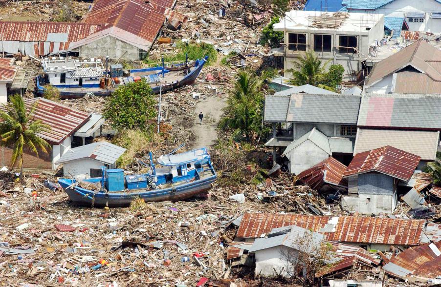
The Indonesian coast, between Banda Aceh and Meulaboh, after the earthquake and the tsunami of 26 December 2004. Photo by Evan Schneider © UN Photo
UNESCO supports Member States in improving capabilities for tsunami risk assessment, implementing early warning systems and enhancing preparedness of communities at risk. UNESCO works closely with national institutions and promotes inter-institutional and regional cooperation. Specialized regional centers provide tsunami information that, together with national analysis, is the basis of the warnings issued for the public. In addition, UNESCO promotes community-based approaches in the development of response plans and awareness campaigns which strongly involve education institutions and end-users.
Upcoming Events
7 August 2024
19 August 2024
19 - 30 August 2024
Chile