Sea Level Monitoring
TSU/MAB Coastal Hazards Project
Advancing Tsunami Early Warning and Mitigation Capacities in North-African Countries
The workshop on Tsunami Early Warning and Mitigation System: Preparing for the next Tsunami in the western Mediterranean region held in Rabat, 15-16 November highlighted the considerable advance in Tsunami Early Warning and Mitigation System in the North-eastern Atlantic, the Mediterranean and connected seas (NEAMTWS) since its establishment in 2005. Participants shared knowledge and experiences regarding existing national early warning systems.
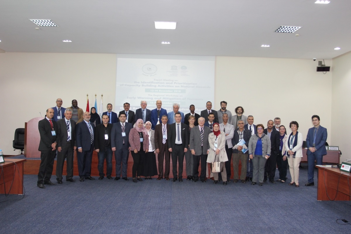
The tsunami workshop was held back-to-back with the meeting on Identification and Prioritization of Capacity-Building Actvities related to Natural Hazards in Rabat, Morocco from 12-14 November 2018 hosted by the Islamic Educational, Scientific and Cultural Organization (ISESCO), the IOC and UNESCO at the ISESCO Headquarters in Rabat.
The workshops were attended by more than 40 participants coming from Morocco, Algeria, Egypt, Mauritania, Tunisia, as well as experts from NEAMTWS existing Tsunami Warning Centers , universities and the Organization for Economic Co-operation and Development (OECD).
Agenda and presentations available at:
http://www.ioc-unesco.org/index.php?option=com_oe&task=viewEventRecord&eventID=2305
International Post-Tsunami Survey: Palu-Donggala Tsunami of 28 September 2018
The 7.5 magnitude earthquake and subsequent tsunami that hit Palu and Donggala in Central Sulawesi Indonesia, Friday 28 September 2018, has killed at least 2,100 people (as on 15 October 2018). Further, some 680 people are missing, 4,612 injured and 78,994 are displaced in over three most affected areas, Donggala, Palu City, and Sigi. In order to improve our understanding of tsunamis and to develop tools and programmes to mitigate their effects, it is vital to learn from this disaster.
Following a request from Indonesia, UNESCO’s Intergovernmental Oceanographic Commission, in collaboration with Indonesian authorities led by the National Commission of Indonesia for IOC-UNESCO and the Coordinating Ministry for Maritime Affairs, will coordinate post-tsunami surveys by International Tsunami Survey Teams (ITST-Palu). These surveys will complement similar efforts by the Indonesian National Survey Teams (NTST-Palu), contribute to understanding the characteristics and impacts of the tsunami, and provide information to Government of Indonesia to enable enhancement of tsunami disaster risk management practices.
Please note that the recommended window for international teams to conduct surveys is during 18 October to 30 November 2018, during which time NTST can provide assistance. It is important to identify an Indonesian collaborator for the field survey and also to obtain appropriate research/survey permit and Visas. Further information is available in these reference documents - (i) Guiding Principles* (ii) Framework and Protocols* (iii) Indonesian Visa & Permit Procedures* and (iv) IOC Manuals and Guides 37 (2nd edition).
The ITST-Palu Coordination Team (ICT) will handle international coordination for this effort. The ICT will be headquartered at the Indian Ocean Tsunami Information Centre (IOTIC) – BMKG Programme Office in Jakarta. ICT will ensure that the scientific surveys are well organised, effective and productive. It will promote sharing of data among field teams, minimise logistical problems for visitors/hosts, link visiting researchers to Indonesian collaborators and provide a summary report to the Government of Indonesia based on reports from all survey teams.
All international researchers planning to undertake post-tsunami field surveys may contact ITST-Palu. Please address all communication to Mr. Ardito M Kodijat, Head IOTIC (This email address is being protected from spambots. You need JavaScript enabled to view it.; This email address is being protected from spambots. You need JavaScript enabled to view it.), cc éd to Srinivasa Kumar Tummala, Head, IOTWMS Secretariat (This email address is being protected from spambots. You need JavaScript enabled to view it.; This email address is being protected from spambots. You need JavaScript enabled to view it.) and Laura Kong, Head, ITIC (This email address is being protected from spambots. You need JavaScript enabled to view it.).
* Updated on 22 October 2018 with information on expedited visa and permit procedures.
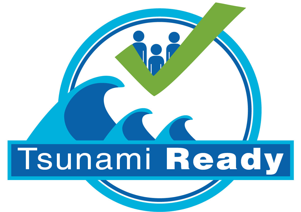
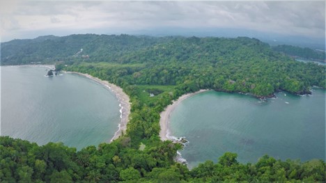
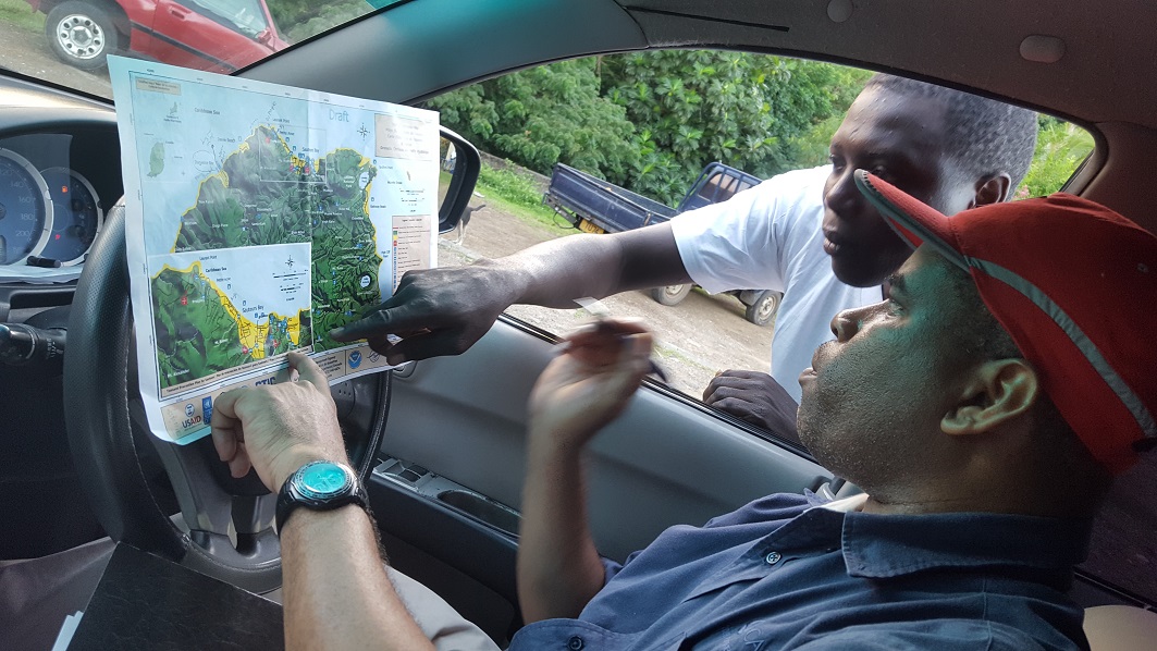
Grenada’s St. Patrick Parish and Haiti’s Fort Liberté recognized “Tsunami Ready”
As many other coastal cities of Northern Haiti, Fort Liberté (over 20,000 habitants) was hit by a tsunami on 7 May 1842. Based on tsunami modelling, the city has an estimate of 2,000 people potentially exposed to tsunami inundation by a local source generated tsunami, leaving very short time to respond. Conscious of the danger, Mr Louis Jacques Etienne, Mayor of Fort Liberté, submitted a request for Tsunami Ready recognition, which was awarded on 28 September 2018. Funded by USAID, the program was implemented with the support of Haiti’s National Civil Protection and Navigation and Maritime Service, and international partners including IOC/UNESCO and its Caribbean Tsunami Information Centre (CTIC), as well as the U.S. National Oceanic and Atmospheric Administration (NOAA)/National Weather Service and its Caribbean Tsunami Warning Program (CTWP).
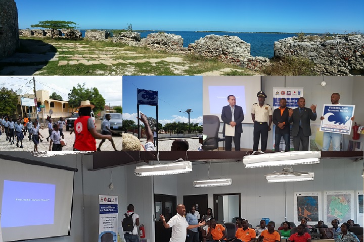
A week earlier, on 20 September 2018, the parish of St. Patrick, Grenada, also received the recognition, empowering one of the country’s most vulnerable coastal communities to take effective action in the event of a potential tsunami. The CTWP and the CTIC implemented the project in collaboration with the Government of Grenada, NGOs and other regional organizations, with funding also provided by USAID.
Achieving Tsunami Ready recognition encompasses a variety of preparedness requirements, including tsunami inundation and evacuation mapping, installation of tsunami signage, distribution of preparedness and outreach materials, public awareness activities and tsunami exercises, preparation of local Standard Operating Procedures for tsunamis, and the identification and training of Local and National Tsunami Focal Points for receiving and disseminating alerts.
The Tsunami Ready recognition is granted only upon the satisfactory completion of a verification process confirming fulfilment of the guidelines – the conduct of the pilot projects in both Haiti and Grenada extended over one and half years. The programme is implemented by IOC’s Intergovernmental Coordinating Group for the Tsunami and Other Coastal Hazards Warning System for the Caribbean and Adjacent Regions (ICG/CARIBE EWS).
St. Patrick Parish and Fort Liberté join over 50 other coastal communities in the Caribbean that have been recognized as Tsunami Ready. The CARIBE EWS Tsunami Ready pilot project is modelled after the successful US TsunamiReady® program executed in Puerto Rico and the US Virgin Islands and an earlier Tsunami Ready project piloted jointly by the IOC/UNESCO and NOAA, which recognized the nominations of Anguilla and the Virgin Islands (UK). Just before Hurricane Irma, the Virgin Islands (UK) had renewed its Tsunami Ready status under the CARIBE EWS Programme.
119,000 people evacuate in Indian Ocean-wide tsunami exercise
A record 119,000 people in the Indian Ocean region evacuated during the Exercise Indian Ocean Wave 2018 (IOWave18) conducted on 4th and 5th September 2018. The exercise was coordinated by the UNESCO’s Intergovernmental Oceanographic Commission (IOC) as part of the Indian Ocean Tsunami Warning and Mitigations System (IOTWMS). Exercise IOWave18 involved enacting two scenarios - a magnitude 9.0 earthquake off the southern coast of the Islamic Republic of Iran and a magnitude 9.3 earthquake off the western coast of Northern Sumatra - on the 4th and 5th September, respectively.
In addition to testing standard operating procedures and communication links at all levels of the tsunami warning chain, a primary objective of Exericse IOWave18 was to enhance tsunami preparedness at community level including evacuation procedures. To this end, all participating Member States [1] were encouraged to use Exercise IOWave18 as an opportunity to evaluate Indian Ocean Tsunami Ready (IOTR) [2] indicators in pilot communities, following the IOTR guidelines.
During the exercise, Tsunami Service Providers (TSPs) of Australia, India and Indonesia issued mock tsunami bulletins to the National Tsunami Warning Centres / Tsunami Warning Focal Points of all participating countries. All twenty-four active IOTWMS countries are reported to have participated in IOWave18, out of which at least 10 countries conducted community evacuations. The evacuations involved residents, tourists, school children, fishing communities, beach goers, marinas and hotels.
The countries that have reported undertaking evacuations and estimated number of people evacuated include India (100,000), Sri Lanka (7,000), Oman (3,225), Indonesia (2,941), Mauritius (553), Tanzania (300), Thailand (300), Kenya (200), Iran (150) and Pakistan (55). Most importantly, at least 6 communities (Jayadevkasaba Pahi, Podhuan, Tantiapal Sasan, Noliasahi, Keutajanga and Venkatraipur) in Odisha province of India and 1 community (AlSawadi AlSahil) in Oman are reported to have evaluated their community preparedness against IOTR indicators, with an intent of achieving Tsunami Ready recognition in the near future.
A public webpage developed by TSP-Australia to display the summary of national tsunami warnings issued by countries in the Indian Ocean was launched during the exercise. The webpage is available at www.bom.gov.au/tsunami/iotwms and marks an important enhancement to the provision of public tsunami information.
There has been substantial engagement of national and international media during Exericse IOWave18. The website www.iowave.org and twitter handle #iowave18 set up by the Indian Ocean Tsunami Information Centre (IOTIC) were actively used for enhancing public awareness. There is additional scope to enhance media participation in future exercises.
In addition to national observers deployed in several countries, experts from Asian and Pacific Centre for the Development of Disaster Information Management (APDIM) of UNESCAP and the Global Disaster Resilience Centre of the University of Huddersfield participated as International Observers in Iran and Sri Lanka respectively. An online survey tool is being used to obtain detailed feedback from participating countries which will be followed by a post-IOWave18 lessons learnt workshop scheduled to be held in Jakarta, Indonesia during November 2018. Inputs obtained from all these sources will be analyzed by the IOWave18 Task Team for identifying gaps and recommending improvements to the end-to-end warning system, that will be presented to the 12th ICG Session scheduled in Kish Island, I.R. of Iran during 3 – 6 March 2019.
IOWave18 is the 5th Indian Ocean wide exercise held by UNESCO-IOC with previous exercises held in 2009, 2011, 2014 and 2016. At its 11th session (Putrajaya, Malaysia, April 2017), the Intergovernmental Coordination Group for the IOTWMS decided to organise IOWave18 and established a Task Team with experts from Australia, India, Indonesia, Oman and Timor Leste to plan and conduct the exercise.
Indian Ocean nations called for the establishment of an Indian Ocean Tsunami Warning and Mitigation System in the wake of the 2004 tsunami disaster. The new System became operational in 2011 with the support of UNESCO’s Intergovernmental Oceanographic Commission (IOC), which continues to coordinate the system’s governance.
UNESCO promotes scientific exchange and collaborative efforts in order to establish effective early warning systems for different hazards such as landslides, volcanoes, earthquakes, floods, droughts and tsunamis. UNESCO’s IOC assists countries improve standard tsunami operating procedures through stakeholder workshops, development and evaluation of ocean wide exercises, as well as overall scientific coordination across regions.
________________________________________
[1] IOTR, modelled on the lines of the CARIBE-EWS Tsunami Ready initiative, is a community performance-based programme that facilitates a structural and systematic approach in building community tsunami preparedness through an active collaboration of the public (community), community leaders, and local and national emergency management agencies.
[2] Australia, Bangladesh, Comoros, France (Reunion Island and Mayotte), India, Indonesia, Iran, Kenya, Madagascar, Malaysia, Maldives, Mauritius, Mozambique, Myanmar, Oman, Pakistan, Seychelles, Singapore, South Africa, Sri Lanka, Tanzania, Thailand, Timor Leste and Yemen.
Chile hosts tsunami early warning experts from the Caribbean, Pacific and Europe in first-ever joint training programme
This is the first time that the training assembles experts from multiple ocean basins, a move that organizers hope will spark renewed scientific dialogue and exchange over best practices across national and regional experiences with tsunami early warning.
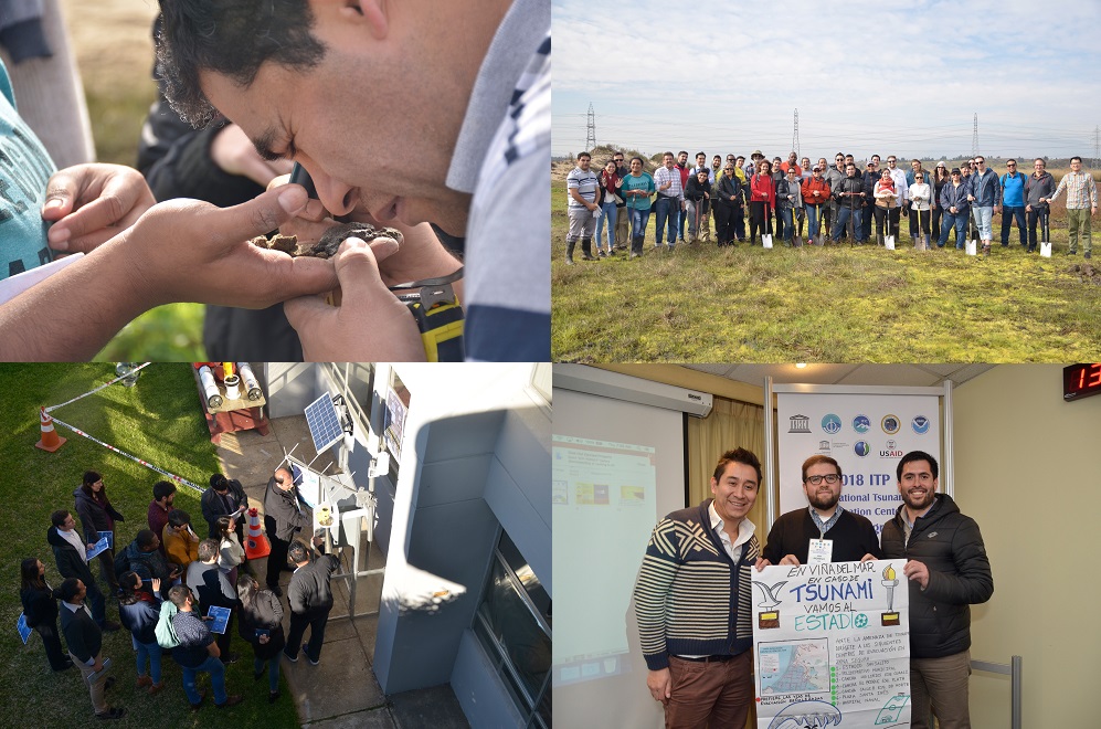 The two-week training (1-10 August 2018) has a dual-focus: the first week focused on earthquake seismology and tsunami hazard assessment for planning and warning decision-making. The second week focused on the tsunami warning and emergency response chain – from tsunami warning centers all the way to the public – stressing the importance of implementing Standard Operating Procedures (SOPs) for enabling authorities to response to tsunamis consistently and rapidly.
The Chile training is the latest in the long-running Training Program on Tsunami Early Warning and Mitigation Systems, organized since 1974 by the International Tsunami Information Center (ITIC) with UNESCO’s Intergovernmental Oceanographic Commission. The ITIC is hosted by the United States’ National Oceanographic and Atmospheric Administration (NOAA) and the Chilean Navy’s Hydrographic and Oceanographic Service (SHOA).
In the aftermath of the Indian Ocean tsunami that claimed nearly 230,000 in fourteen countries, the IOC ITIC Training Program helped prepare national agencies participating in regional tsunami early warning systems to pre-plan and develop protocols to warn quickly and evacuate the public as early and orderly as possible. More than 120 trainings have been conducted since 2005 reaching more than 3000 national officials globally.
More Articles...
About the Tsunami Programme
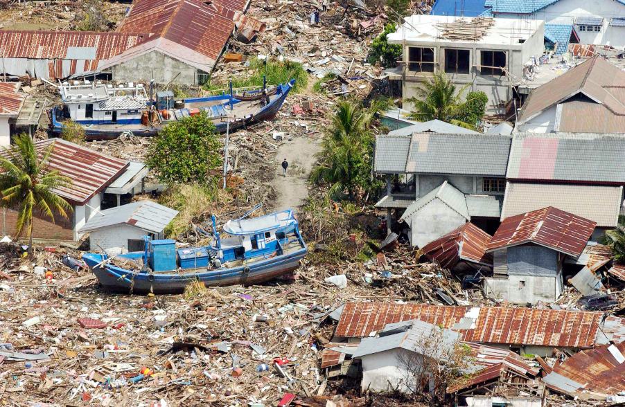
The Indonesian coast, between Banda Aceh and Meulaboh, after the earthquake and the tsunami of 26 December 2004. Photo by Evan Schneider © UN Photo
UNESCO supports Member States in improving capabilities for tsunami risk assessment, implementing early warning systems and enhancing preparedness of communities at risk. UNESCO works closely with national institutions and promotes inter-institutional and regional cooperation. Specialized regional centers provide tsunami information that, together with national analysis, is the basis of the warnings issued for the public. In addition, UNESCO promotes community-based approaches in the development of response plans and awareness campaigns which strongly involve education institutions and end-users.
Upcoming Events
7 August 2024
19 August 2024
19 - 30 August 2024
Chile