Sea Level Monitoring
TSU/MAB Coastal Hazards Project
Post-Exercise Indian Ocean Wave 2018 and Indian Ocean Tsunami Ready Workshop highlights recent achievements in community readiness
The Intergovernmental Coordination Group for the Indian Ocean Tsunami Warning and Mitigation System (ICG/IOTWMS) and the Indian Ocean Tsunami Information Centre (IOTIC) held back-to-back events in Jakarta, Palu and Citeko, Indonesia during 12 November – 01 December 2018. These events focused on community preparedness for tsunami events with emphasis on lessons learnt from the Indian Ocean Wave Exercise (IOWave18) conducted on 4 and 5 September 2018 and the Palu earthquake and tsunami of 28 September 2018.
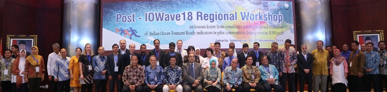
Participants and distinguished delegates at the opening session of the Post-IOWave workshop, BMKG, Jakarta, Indonesia.
The UNESCO-IOC events included:
• International Tsunami Survey Team pre and post-field study briefings: 12 November 2018
• Post-IOWave Regional Workshop on Lessons Learnt from Community Participation and evaluation of IOTR indicators in pilot communities during Exercise Indian Ocean Wave 2018: 15 - 17 November 2018
• Study visit to Palu, Sulawesi to witness the effects of the 28 September 2018 earthquake, tsunami and liquefaction: 18 November 2018
• 13th Meeting of the ICG/IOTWMS Steering Group: 19 - 21 November 2018
• 3rd training on Tsunami Evacuation Maps, Plans and Procedures: 22 November - 01 December 2018
The International Tsunami Survey Team (ITST) pre and post-field study briefings were overseen by the Indian Ocean Tsunami Information Centre (IOTIC) and International Tsunami Information centre (ITIC), and were organized at the offices of the Ministry of Research Technology and Higher Education (MORTHE) of the Government of Indonesia on 12 November 2018. So far, 7 Teams (68 scientists from 19 countries and Indonesia) visited Palu, Sulawesi where the M7.4 earthquake, tsunami and liquefaction have resulted in over 2,100 deaths, 1,000 persons missing and 70,000 persons displaced. Data collection included tsunami flow depths and inundation limits, damage to buildings and infrastructure, and eyewitness interviews. In addition, a team of IOTWMS representatives from India, Oman, Thailand and the Secretariat undertook at study visit to Palu supported by representatives from the BMKG Jakarta and Palu offices.
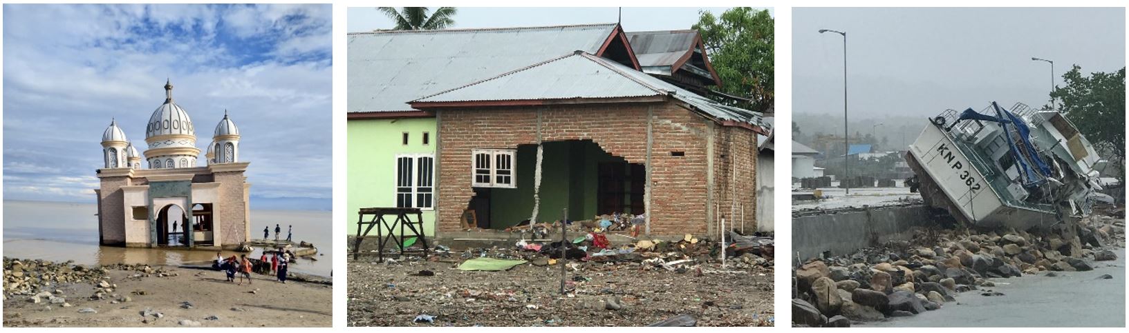
Pictures showing impact of the devastating tsunami of 28 September 2018.
The Post-IOWave Regional Workshop on Lessons Learnt from Community Participation and evaluation of IOTR indicators in pilot communities during Exercise Indian Ocean Wave 2018 was held in Jakarta during 15–17 2018. This workshop was part of the IOTIC-BMKG programme for 2018 and was attended by more than 24 participants from 12 countries. Notably, during Exercise IOWave18 a record 119,000 people participated in community evacuations and importantly, 6 communities in India and 1 community in Oman evaluated Indian Ocean Tsunami Ready indicators.
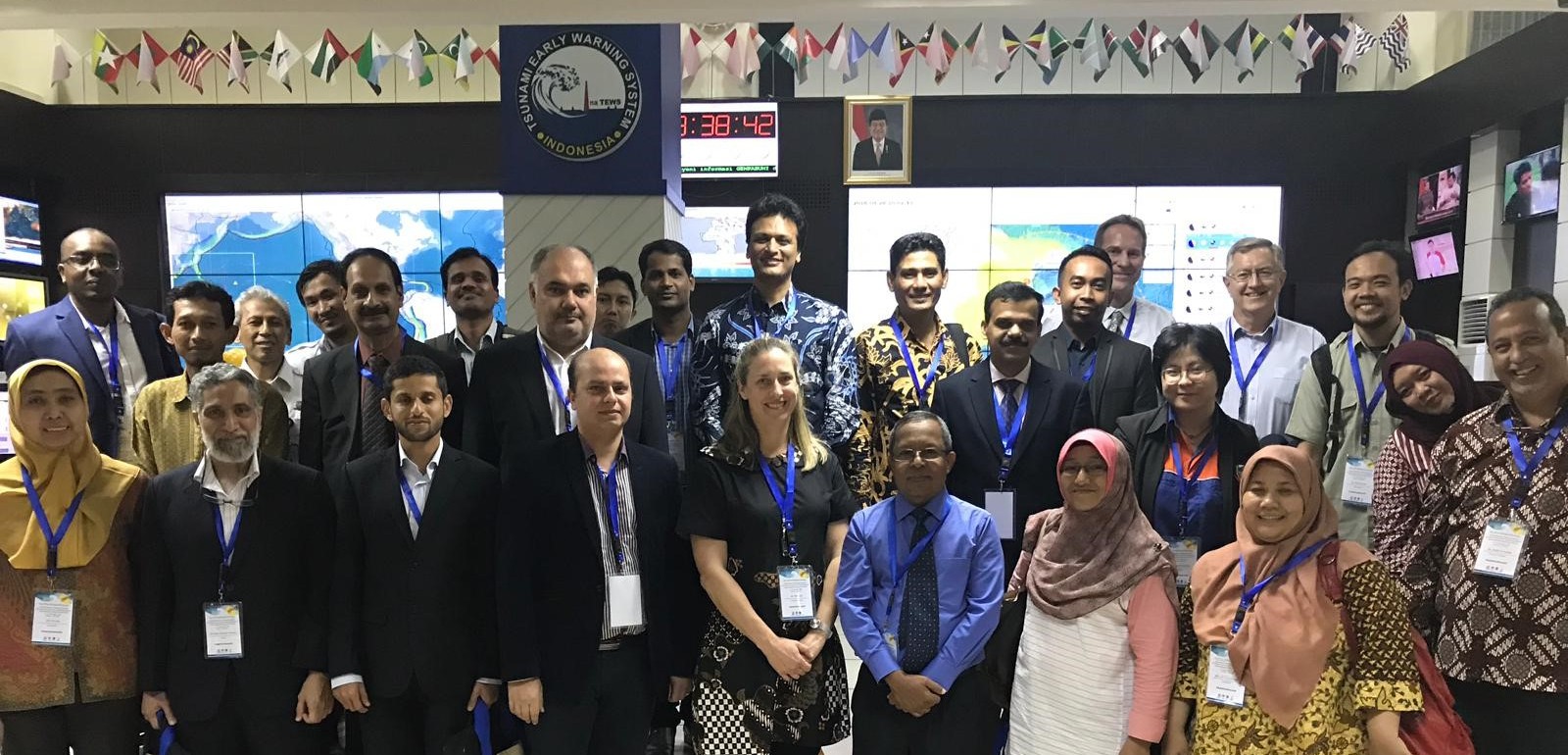
Participants tour the Tsunami Early Warning Centre of Tsunami Service Provider Indonesia during the regional post-IOWave18 workshop, Jakarta, Indonesia.
The 13th Meeting of the ICG/IOTWMS Steering Group was attended by 13 participants from five countries, invited experts/observers, and UNESCO-IOC staff members. The Steering Group discussed the Palu, Sulawesi earthquake and tsunami, work plans of its Working Groups and Task Teams, and plans for the upcoming ICG/IOTWMS-XII to be held in Kish Island, Iran (9–12 March 2019) immediately following the Expert Consultation on Scientific Tsunami Hazard Assessment of the Makran Subduction Zone (8 March 2019). The Expert Consultation aligns with the Steering Group recognition of near-field events as a priority for capacity development, particularly in the Makran Subduction Zone, which is poorly understood even though it poses a major tsunami risk in the North West Indian Ocean.
The Training on Tsunami Evacuation Maps, Plans and Procedures (TEMPP-3) was held at BMKG training centre in Citeko, Indonesia during 22 November – 1 December 2018. This is the 3rd in a series of TEMPP trainings organised under the IOTIC-BMKG programme and was attended by 20 participants from 7 countries and trainers from India, Indonesia, and IOC UNESCO. Throughout the training, participants collaborated in the development of tsunami inundation and evacuation maps. The maps were produced using ComMIT and QGIS software and underpinned by national near-coast bathymetry and topography data in conjunction with freely available global bathymetric data. Participants also drafted templates of public display of tsunami information and discussed evacuation response plans, standard operating procedures and exercise planning.
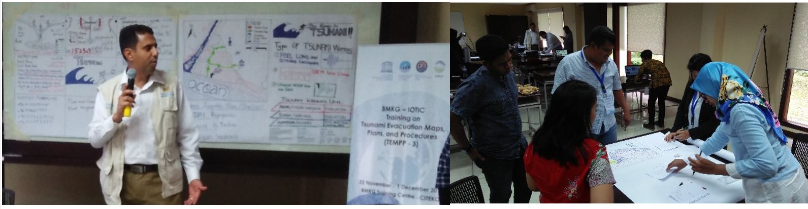
Participants creating public displays of tsunami information during the Tsunami Training on Tsunami Evacuation Maps, Plans and Procedures (TEMPP-3), Citeko, Indonesia.