Sea Level Monitoring
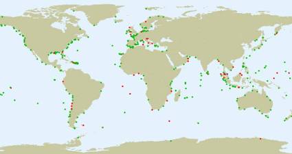
TSU/MAB Coastal Hazards Project
Greek Tsunami Service Provider Announces the Deployment of New Tsunami Information Products
The Greek Tsunami Service Provider NOA-HLNTWC has recently announced that, starting in March, they will be providing enhanced tsunami products to their subscribers in the form of maps. Tsunami Service Providers (TSPs) in the North-Eastern Atlantic, Mediterranean and connected seas (ICG/NEAMTWS), in particular KOERI-TSP (Turkey), have piloted tsunami enhanced products since 2017 in addition to text tsunami bulletins shared to their subscribers. Following the ICG/NEAMTWS developments, NOA-HLNTWC, the Greek TSP, will also provide enhanced tsunami products based on an updated Decision Matrix (DM).
The new DM is a modified version of the official NEAMTWS DM. In the event of an earthquake, the DM defines the alert level at each forecast point depending on the estimated potential of a possible tsunami. Depending on the alert level, different messages are issued by TSPs. An information bulletin (green) is released at the lowest level, followed by a local, regional or basin-wide Tsunami Advisory (orange). The highest level of alert is the Tsunami Watch (red). The DM's new changes, which came into force on 1 March 2021, concern four earthquake magnitude classes where the threshold values have been elevated by one step and an extra earthquake magnitude class has been added.
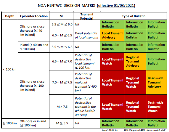
Dr. Nikos Kalligeris, the Tsunami National Contact of Greece and Operational Head of the Hellenic National Tsunami Warning Center that operates in the Institute of Geodynamics, National Observatory of Athens, said that the updated DM was used and tested during the recent NEAMWave exercise (NEAMWave21) as it had already been incorporated in the exercise manual. The NEAMWave21 tsunami exercise took place from 8 to 10 March 2021 and included three different tsunami scenario simulations across the Mediterranean basin.
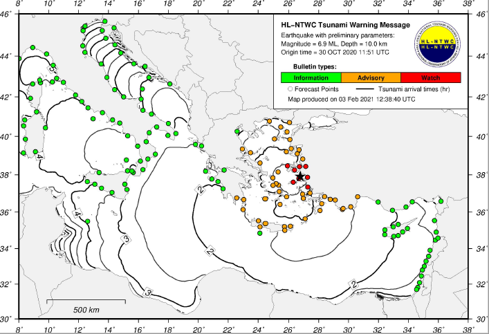
Sample map of HL-NTWC for the 2020 Samos event (30th of October), based on the updated DM.
Dr. Kalligeris also announced that all future Tsunami Warning Messages (TWMs), starting from 1 March 2021, will include a map consisting of the alert level at each Tsunami Forecast Point (FP) as well as the Tsunami Travel Time (TTT) contours plotted in 30 minutes intervals. The contours plotted with a thin line correspond to the half-hour intervals, whereas the contours plotted with the thick line correspond to the hour intervals, represented with the respective hours after the earthquake's occurrence (in boxes).