Sea Level Monitoring
TSU/MAB Coastal Hazards Project
Building Capacity in the North-West Indian Ocean Region in Tsunami Inundation Mapping and Evacuation Planning
Capacity building workshops on tsunami inundation mapping and tsunami evacuation planning were held as part of the UNESCO-IOC project on “Strengthening Tsunami Early Warning in the North-West Indian Ocean through Regional Cooperation – Phase 2c” with funding from the United Nations Economic and Social Commission for Asia and the Pacific (UNESCAP) Tsunami Trust Fund.
The workshops were hosted during 21-25 April 2024 by the Directorate General of Oman Meteorology of the Civil Aviation Authority in Muscat, Oman. Around 40 participants in tsunami warning, research, and disaster management from India, Iran, Pakistan, Oman, and the United Arab Emirates (UAE) attended the events in-person with a further 25 joining the online sessions. The workshops were facilitated by trainers from the UNESCO-IOC Indian Ocean Tsunami Information Center (IOTIC), UNESCO-IOC Secretariat for the Intergovernmental Coordination Group for the Indian Ocean Tsunami Warning and Mitigation System (ICG/IOTWMS), Germany, Indonesia, Iran, Italy, and Norway.
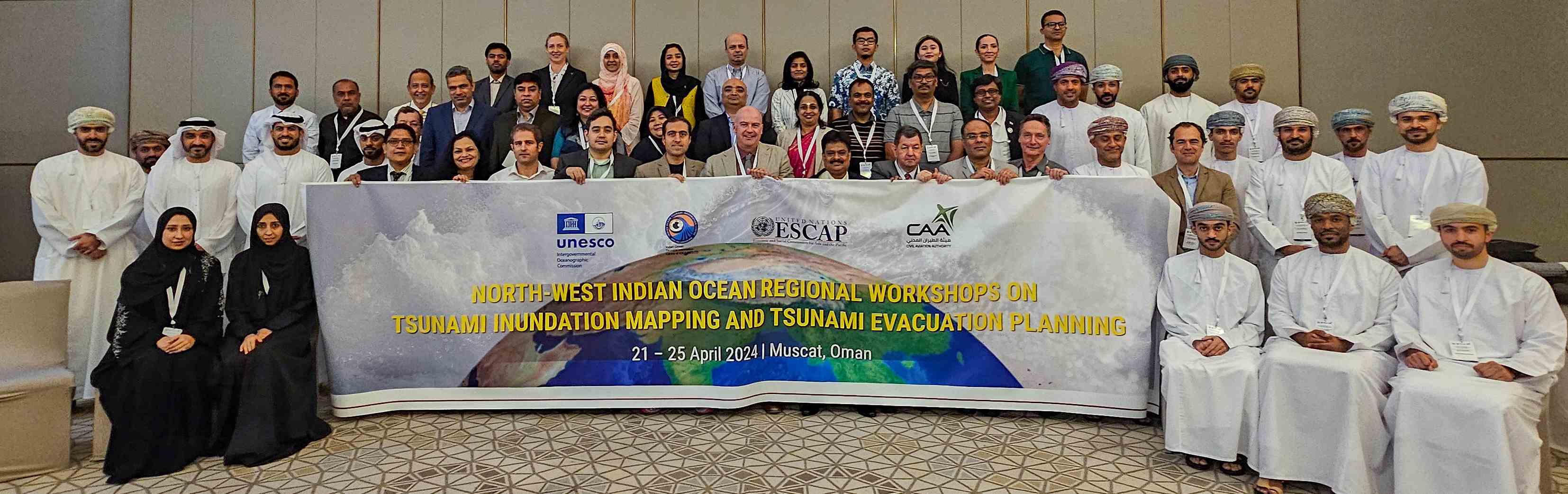
Participants at the workshops on tsunami inundation mapping and tsunami evacuation planning in Muscat, Oman during 21-25 April 2024.
The workshops provided the opportunity to review existing tsunami inundation maps and develop plans for enhanced inundation maps using outcomes from the Probabilistic Tsunami Hazard Assessment (PTHA) work of the project. The PTHA for the North-West Indian Ocean (NWIO) was developed with the support of the German Research Centre for Geosciences (GFZ), Italian National Institute of Geophysics and Volcanology (INGV), Norwegian Geotechnical Institute (NGI), and Indian Nation Centre for Ocean Information Systems (INCOIS). The workshops also helped to build capacity in tsunami evacuation mapping in the project pilot areas in India (Kerela), Iran (Chabahar and Jask), Pakistan (Gwadar and Karachi), Oman (Al Hail North), and UAE (Fijairah). Participants commented that the sharing of experiences in tsunami inundation and evacuation mapping among neighbouring counties was valuable for refining their implementation processes in-country.
Following the workshops and as part of the project, national teams supported by the project will organise stakeholder meetings to refine the tsunami evacuation maps initiated during the workshops, and then test the maps through community exercises. Similar consultations will be held and supported to develop and test tsunami evacuation maps for the other pilot areas.
Presentations and documents from the workshops are available at:
- Tsunami Inundation Mapping (https://oceanexpert.net/event/3999)
- Tsunami Evacuation Planning (https://oceanexpert.net/event/4000)