Sea Level Monitoring
TSU/MAB Coastal Hazards Project
US Virgin Islands hosted the Ninth session of the Caribbean tsunami Warning System
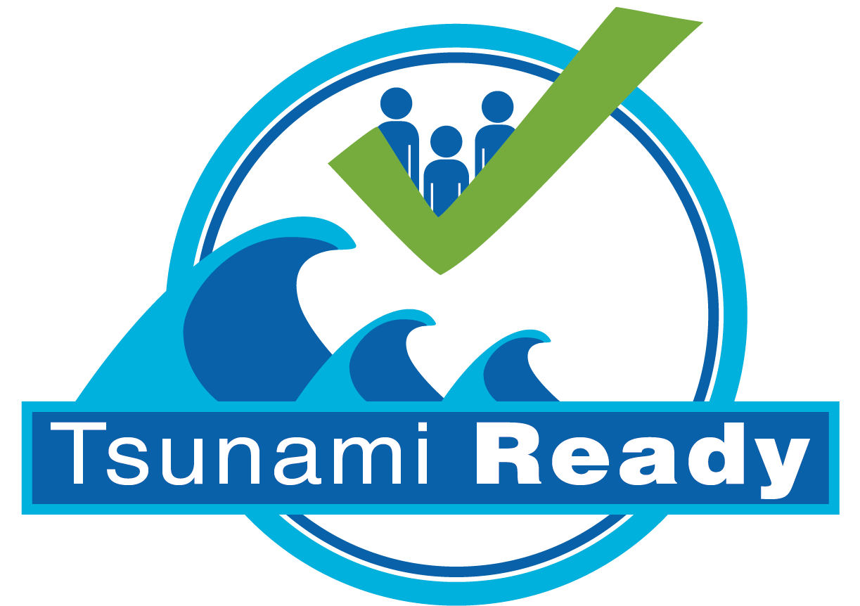
The US Virgin Islands has been designated as Tsunami Ready by the United States Department of Commerce, National Oceanic and Atmospheric Administration, NOAA. "We have worked long and hard for this recognition and as a result of our efforts, the territory is better prepared to save lives from the onslaught of tsunamis through our extensive planning, education and public awareness. It is not a matter of if, but a matter of when," Governor de Jongh said at the recognition ceremony that was held during the Ninth session of the Intergovernmental Coordination Group for the Tsunami and Other Coastal Hazards Warning System for the Caribbean and Adjacent Regions (ICG/CARIBE-EWS-IX).
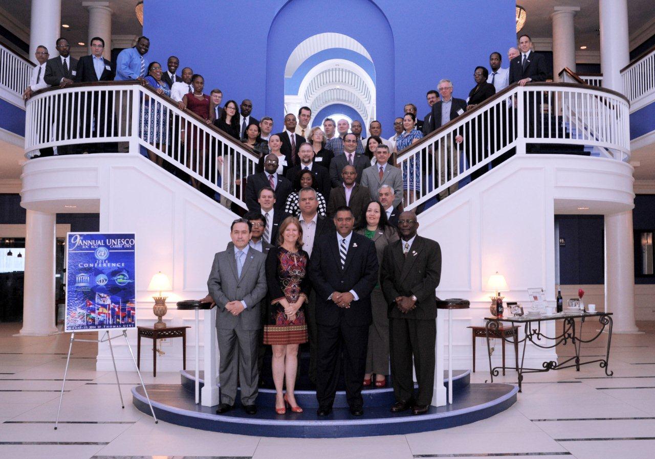
The ICG/CARIBE-EWS-IX was held in St Thomas, US Virgin Islands, from 13 to 15 May 2014, hosted by the Virgin Islands Territorial Emergency Management Agency (VITEMA). The meeting was attended by 56 participants from 15 Caribbean countries and territories and 5 organizations: Caribbean Tsunami Information Centre [CTIC], Science Applications International Corporation [SACI], Puerto Rico Seismic Network [PRSN], UNAVCO, Inc., and the University of the West Indies Seismic Research Centre [SRC]).
TsunamiReady is granted by NOAA once certain requirements are met such as establishing an emergency operations center and a 24-hour warning point to receive tsunami information.
Countries represented at the conference included Barbados, Colombia, Curacao, Dominican Republic, France, Haiti, Mexico, Netherlands, Panama, Trinidad and Tobago, Saint Lucia, Sint Maarten, the United Kingdom, the United States and Venezuela.
The gathering noted the achievements in 2013-2014 including the launching of the Caribbean Tsunami Information Center (CTIC), established in Barbados; the successful CARIBE WAVE 2014, on March 26, 2014, with 47 of the 48 MS and territories participating and almost 200,000 people signing up for. It also noted the increased number of communities receiving the TsunamiReady recognition in the region.
Participants called for Member States contributions towards the Caribbean Tsunami Information Center (CTIC) to enable it to fully play its role as a key instrument for tsunami preparedness and awareness in the Caribbean region.
The Oman National Multi Hazard Early Warning System 2nd Workshop on Standard Operating Procedures for Tsunami Early Warning Systems
The Directorate General of Meteorology and Air Navigation / Public Authority for Civil Aviation of Oman (DGMAN/PACA) in collaboration with IOC UNESCO held the second Standard Operating Procedures (SOP) Workshop for Tsunami Early Warning Systems in Muscat, Oman, June 8-9 2014. The workshop was attended by 43 participants from different responsible government stakeholders involved in the National Multi-Hazards Early Warning System (NMHEWS) that Oman is developing. The workshop was officially opened by Mr.Abdul Rahim al Harmi, the Chairman of National Steering Committee of NMHEWS and Tsunami National Contact for the Intergovernmental Coordination Group for the Indian Ocean Tsunami Warning and Mitigation System (ICG/IOTWS) IOTWS for the Sultanate of Oman.
In his opening speech, Dr.Juma al Maskari, Assistant Director-General for Meteorology of PACA and the chairman of the Technical Committee of NMHEWS, summarised the results of the first SOP workshop held in October 2013. He informed that the phase 1 development of the NMHEWS was in its final stages and that the system is expected to be inaugurated in March 2015, followed by an international symposium on tsunami science and the 10th Session of the ICG/IOTWS. The representatives of DGMAN presented the progress of the development of the NMHEWS; the Action Plan; and the status of SOP development. The Head of ICG/IOTWS Secretariat, Mr Tony Elliott, provided an overview of the Indian Ocean Tsunami Warning and Mitigation System (IOTWS) and the Regional Tsunami Service Provider (RTSP) products and services. He also gave a presentation on SOPs for Tsunami Warning Centres. The Head of the Indian Ocean Tsunami Information Centre (IOTIC), Mr Ardito Kodijat, gave a presentation on the services provided by IOTIC. On the second day of the workshop, Aridito Kodijat gave a presentation on Community Preparedness focusing on Evacuation Planning. The Principles of end-to-end Tsunami Early Warning and Tsunami Warning Decision Support Tools were presented by the IOC UNESCO Coordinator for the NMHEWS project, Dr Fauzi.
For the second part of Day 2 the participants were divided into 7 groups to conduct an exercise on developing SOPs for tsunami emergency response using timeline template tools. Each of the groups then presented the SOPs they had developed to the other groups.
At the closing of the workshop, the participants agreed to continue to work on their SOPs and prepare for their integration into the national goal of reducing the risk of tsunami disaster, especially considering the schedule for completion of the NMHEWS by the end of March 2015.
Preparing for NEAMWave14 tsunami exercise
The next tsunami exercise for the North-Eastern Atlantic, Mediterranean and connected seas will be held on 28-30 October 2014.
NEAMWave14 will involve the simulation of the assessment of a tsunami, based on an earthquake-driven scenario followed by alert message dissemination by CTWPs (Phase A) and continued with the simulation of the TWFP/NTWCs’ and CPAs’ actions (Phase B), as soon as the message produced in Phase A has been received. In addition as soon as the message produced in Phase A has been received by the European Commission Emergency Response and Coordination Centre (ERCC) the simulation continues at international level with the activation of the Union Civil Protection Mechanism (Phase C) for international assistance.
In order to prepare for the exercise a worksho has been organized on 10 June 2014 in Brussels by the IOC with the European Commission Directorate General Humanitarian Aid and Civil Protection (EC DG ECHO). The workshop had the main objective to present NEAMWave14 objectives and procedures to the Civil Protection Authorities of the NEAM region. Moreover, it was the occasion for the DG ECHO to present the activities of the ERCC to the NEAM community. NEAMWave14 will also help to strengthen the collaboration between them and IOC on tsunami preparedness. Moreover information on the ERCC can be found on their website:
http://erccportal.jrc.ec.europa.eu/About-ERCC
For more information on NEAMWave14:
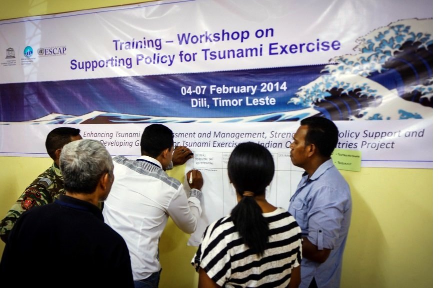
Development and Strengthening of Tsunami Exercise Policies in Bangladesh, Myanmar and Timor Leste
The IOC UNESCO project on “Enhancing Tsunami Risk Assessment and Management, Strengthening Policy Support and Developing Guidelines for Tsunami Exercises in Indian Ocean Countries” is being jointly implemented by the Intergovernmental Coordination Group for the Indian Ocean Tsunami Warning and Mitigation System (ICG/IOTWS) and the Indian Ocean Tsunami Information Centre (IOTIC). The project aims to support the development and strengthening of tsunami exercise policies in the three pilot countries of Bangladesh, Myanmar and Timor Leste. The project is supported through a grant from the United Nations Economic and Social Commission for Asia Pacific (UNESCAP) Trust Fund for Tsunami, Disaster and Climate Preparedness.
In each pilot country, a stock taking survey designed to assess disaster risk reduction policies relating to tsunami has been undertaken. The survey addresses tsunami risk, hazard, exercise activities and emergency response standard operating procedures via consultation with two main stakeholders in each country.
Training modules on Policy Support and Guidelines for Tsunami Exercises were developed by an expert team comprised of researchers, scientists, government representatives and Disaster Risk Reduction specialists from Indonesia, Malaysia, Pakistan, Sri Lanka and New Zealand. Based on IOC Manuals and Guides Series No. 52: “Tsunami Risk Assessment and Mitigation for the Indian Ocean”, and No. 58: “How to Plan, Conduct and Evaluate Tsunami Exercises”, two training modules were developed, which will be implemented in two separate workshops in three pilot countries. The first training module focuses on the development of national policies to support a sustainable tsunami exercise programme. The second module focuses on how to plan and implement tsunami exercises. The training workshops will assist the three target countries to prepare and actively participate in the upcoming Indian Ocean Wave Exercise scheduled to take place in September 2014. Workshops on the first training module have been undertaken in Dhaka, Bangladesh in November 2013 and in Dili, Timor Leste in February 2014.
Brazil, Monaco, the European Union and St Vincent & the Grenadines contribute to strengthening the sea level observation network to monitor tsunamis and other coastal hazards in the Caribbean.

In the past 500 years, more than 75 tsunamis have been documented in the Caribbean and adjacent regions. Since 1842, 3446 people are reported to have perished to these killer waves. The tsunami generated by the 2010 Haiti earthquake claimed several lives, but the most recent devastating events were the 1946 tsunamis of the Dominican Republic, with at least 1800 victims.
The most destructive known events have occurred in: 1692 in Port Royal, Jamaica; 1770 in Port-au-Prince, Haiti; 1842 in Port-de-Paix and Cap Haitian; 1867 in Charlotte Amalie, US Virgin Islands; 1882 in San Blas Islands, Panama; 1918 in US Puerto Rico and 1946 in Matanzas, Dominican Republic.
Since then, there has been an explosive increase in residents, visitors, infrastructure, and economic activity along Caribbean coastlines, increasing the potential for human and economic loss.
For tsunami-prone areas, UNESCO's tsunami coordination experience in the Pacific has shown that a proper network of sea level measurement stations do help to provide timely and accurate Early Warnings. With this in mind, the Intergovernmental Oceanographic Commission (IOC) of UNESCO (IOC-UNESCO) commissioned six (6) brand new sea level stations, for Haiti (2), Cayman Islands, Guatemala,St Vincent & The Grenadines and St Kits & Nevis. The stations were installed with the support of Brazil, the European Union, Monaco and St Vincent & The Grenadines; they are now up and running and delivering data through the IOC Sea Level Monitoring Facility
IOC-UNESCO is committed to continue developing end-to-end coastal hazard early warning systems, to save lives and increase tsunami preparedness and readiness in the Caribbean.
More Articles...
- Tsunami Standard Operating Procedures (SOP) training in the Caribbean
- Collection of Eyewitness Interviews and Historical Documents on the 1945 Makran Tsunami
- Regional Workshop on Standard Operating Procedures for Tsunami Warning and Emergency Response for Northern and Eastern Indian Ocean Countries
- JMA's brochure about the Lessons Learned from the Earthquake and Tsunami in 2011
About the Tsunami Programme
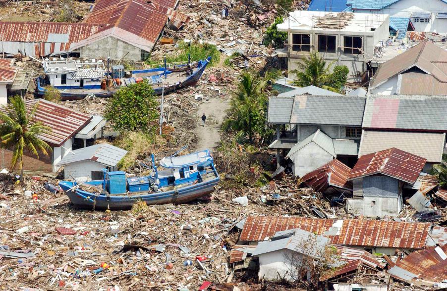
The Indonesian coast, between Banda Aceh and Meulaboh, after the earthquake and the tsunami of 26 December 2004. Photo by Evan Schneider © UN Photo
UNESCO supports Member States in improving capabilities for tsunami risk assessment, implementing early warning systems and enhancing preparedness of communities at risk. UNESCO works closely with national institutions and promotes inter-institutional and regional cooperation. Specialized regional centers provide tsunami information that, together with national analysis, is the basis of the warnings issued for the public. In addition, UNESCO promotes community-based approaches in the development of response plans and awareness campaigns which strongly involve education institutions and end-users.
Upcoming Events
7 August 2024
19 August 2024
19 - 30 August 2024
Chile