Sea Level Monitoring
TSU/MAB Coastal Hazards Project
Paleotsunami workshop conducted in Banda Aceh
As part of the “Assessment and Awareness of Makran Tsunami Hazards” project funded by the UNESCAP Multi-Donor Trust Fund, a 10-day workshop was held in Banda Aceh, Indonesia, from 10-20 July 2010. Ten scientists from Pakistan and five from Indonesia joined with five international experts in palaeotsunami research to gain experience in assessing tsunami hazards and increasing awareness of them. The group was hosted by the Tsunami Disaster Mitigation and Research Centre (TDMRC) at Syiah Kuala University, Banda Aceh.
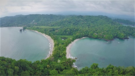
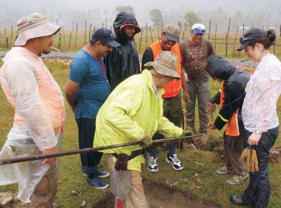 The group visited several significant sites in Banda Aceh city, including the Tsunami Museum and field sites in coastal areas where sedimentological evidence of the 2004 tsunami can be seen. The group learned about palaeotsunami research through practical experience, digging many trenches and taking cores in relevant sites. They also interviewed eyewitnesses of the 2004 tsunami to gain an understanding of the sociological impact of such events.
Caribbean Home
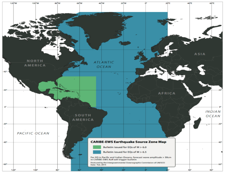
The Intergovernmental Coordination Group for the Tsunami and Other Coastal Hazards Warning System for the Caribbean and Adjacent Regions (ICG/CARIBE-EWS) was established in 2005 and is currently comprised of 32 Member States and 16 Territories in the Caribbean. The ICG/CARIBE-EWS coordinates international tsunami warning and mitigation activities, including the issuance of timely and understandable tsunami bulletins in the Caribbean and adjacent regions. The guidelines for the ICG/CARIBE EWS activities are compiled in the CARIBE EWS Implementation Plan
In recent years, there has been a considerable population growth and influx of tourists along the Caribbean and western Atlantic coasts increasing the tsunami vulnerability of the region. Available seismic data and historical records show that the region is highly exposed to tsunamis and other coastal hazards. Historical trends suggest that potentially destructive tsunamis occur at an average rate of 1-2 per century in the Caribbean. The importance of coastal zones in the economic activities of Caribbean countries augments the vulnerability to tsunamis and other coastal hazards and increases the underlying risk factors. It is acknowledged that the potential for human and economic loss is severe. On any day, it is estimated that about 500,000 people could be in harm’s way just along the beaches.
The risks of major earthquakes in the Caribbean and adjacent regions, and the possibility of a resulting tsunami, are real and should be taken seriously.
OFFICERS
Chairperson
Mr Gerard Metayer (Responsable du Dossier Tsunami, Service Maritime et de Navigation d'Haiti, Haiti)
Vice-Chairpersons
Ms Regina Browne (Deputy Director, Planning & Preparedness, Virgin Islands Territorial Emergency Management Agency, USA)
Mr Anthony Murillo Gutierrez (Sistema Nacional de Monitoreo de Tsunamis (SINAMOT), Costa Rica)
Ms Marie-Noëlle Raveau (Disasters management and public awareness, Collectivité Territoriale de Martinique, France).
Documents
Documents go here - this will be mainly Paperclip functionality on the final site
Paperclip will autmatically display all the document lists associated with the site; you can either change the 'documents' menu item to point to that URL or make your own custom page here with a link to the document lists on it.
About the Tsunami Programme
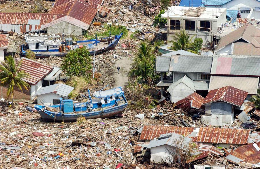
The Indonesian coast, between Banda Aceh and Meulaboh, after the earthquake and the tsunami of 26 December 2004. Photo by Evan Schneider © UN Photo
UNESCO supports Member States in improving capabilities for tsunami risk assessment, implementing early warning systems and enhancing preparedness of communities at risk. UNESCO works closely with national institutions and promotes inter-institutional and regional cooperation. Specialized regional centers provide tsunami information that, together with national analysis, is the basis of the warnings issued for the public. In addition, UNESCO promotes community-based approaches in the development of response plans and awareness campaigns which strongly involve education institutions and end-users.
Upcoming Events
7 August 2024
19 August 2024
19 - 30 August 2024
Chile